Geomatics/Geospatial
Welcome to Barnes & Duncan’s Geospatial Services! Our comprehensive suite of cutting-edge technologies and expertise is designed to meet all your geospatial needs with precision and accuracy. Here’s an overview of the services we offer:
3D Laser Scanning
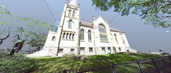
Experience unparalleled precision and detail with our state-of-the-art 3D laser scanning technology. We employ advanced laser scanners to capture highly accurate three-dimensional representations of your environment. Whether it’s for architectural preservation, engineering design, or construction planning, our scanning services provide the foundation for informed decision-making and seamless project execution.
UAV Photogrammetric Mapping

Take your mapping projects to new heights with our UAV (Unmanned Aerial Vehicle) photogrammetric mapping services. Using cutting-edge drones equipped with high-resolution cameras, we capture detailed aerial imagery of your site. Through advanced photogrammetric techniques, we transform these images into precise, georeferenced maps and 3D models, enabling you to gain valuable insights and make informed decisions with confidence.
UAV LiDAR Mapping
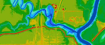
Harness the power of LiDAR (Light Detection and Ranging) technology for unparalleled accuracy in terrain mapping and analysis. Our UAV LiDAR mapping services utilize advanced laser scanning sensors mounted on drones to capture elevation data with exceptional detail and speed. From terrain modeling to infrastructure planning and environmental monitoring, our LiDAR mapping solutions empower you to extract valuable information efficiently and accurately.
GIS (Geographic Information System)
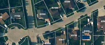
Unlock the full potential of your spatial data with our comprehensive GIS services. Our team of experienced GIS professionals leverages cutting-edge software and analytical tools to organize, analyze, and visualize geospatial data effectively. Whether you need custom GIS application development, spatial analysis, or data visualization solutions, we provide tailored services to meet your specific requirements and help you derive actionable insights from your data.
Bathymetric Surveys
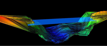
Explore the depths with confidence through our bathymetric surveying services. Using advanced sonar technology, we capture detailed underwater topographic data to map and analyze submerged features such as lake beds, and river channels. Whether it’s for marine navigation, environmental assessment, or hydrographic mapping, our bathymetric surveying solutions deliver accurate and reliable results to support your projects.
Construction Surveying
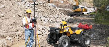
Barnes & Duncan specializes in controlled layout for various projects, ensuring accuracy and attention to detail. We use the latest technology to deliver measurement solutions to construction layout challenges.
Layout Services Offered:
- Site Layout
- As-built mapping
- Specialized Layout
- Building corners
- Machine Control management
Control Surveys
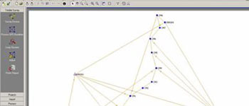
Control surveys establish a common, consistent network of physical points that are the basis for controlling the horizontal and vertical positions of improvement projects and facilities. Horizontal and vertical control points are used to establish a framework around which other surveys can be completed and referenced. These control surveys are used for various construction projects such as: roadway, utility lines, underground utilities, tunnels, bridges, and buildings.
Deformation Surveys
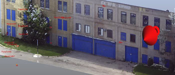
A deformation survey is a survey to determine if a structure or object is changing shape or moving. The three-dimensional positions of specific points on an object are determined, a period of time is allowed to pass, these positions are then re-measured and calculated, and a comparison between the two sets of positions is made.

